Homepage

Cumbria's unique natural environment is a vital part of our county's cultural identity. It provides habitats for some of England’s most threatened species and delivers wider benefits that our communities and economy rely on. The environment underpins the wellbeing of local people and the prosperity of the county.
Cumbria’s Local Nature Recovery Strategy (LNRS) is a call to action. It is an inspiration for anyone who wants to play their part in addressing the biodiversity and climate crises. The LNRS is a tool that prioritises nature recovery in places where it will have the greatest impact for people and nature. Everyone working to address biodiversity loss in Cumbria is contributing to a bigger picture of nature recovery and everyone can play their part.
The LNRS has been produced collaboratively by those who live in, work in, or visit Cumbria. It will help us take informed action to create more places where wildlife and people can thrive. Together, we can make a change and create a lasting legacy of nature recovery.
Priorities for nature recovery
The Cumbria LNRS priorities for nature recovery are:
- Priority 1: Habitat mosaics
- Priority 2: Invasive non-native species
- Priority 3: Data and mapping
- Priority 4: Safeguarding our habitats and species
- Priority 5: Skills, delivery, and funding
- Priority 6: People taking action for nature
- Priority 7: Farming and nature
- Priority 8: Sustainable forest management
- Priority 9: Create and connect woodland
- Priority 10: Ancient woodland and ancient and veteran trees
- Priority 11: Hedgerows and scrub
- Priority 12: Forestry and nature
- Priority 13: Restore upland bog habitats
- Priority 14: Enhance and restore heathland habitats
- Priority 15: Montane habitats
- Priority 16: Conserve and enhance existing wildlife-rich grasslands
- Priority 17: Create and connect wildlife-rich grassland
- Priority 18: Limestone pavement
- Priority 19: Restore natural function/processes
- Priority 20: Enhance and restore wetland habitats
- Priority 21: Water quality
- Priority 22: Restore and enhance coastal habitats
- Priority 23: Create space for coastal dynamism
- Priority 24: Marine nature recovery
- Priority 25: Manage and enhance our built environment
- Priority 26: Create more wildlife-rich habitat within our built environment
- Priority 27: Species recovery
Cumbria’s natural landscape
Cumbria is the third largest county in England (6,768 km2). It has diverse geology, topography, and climate, but with only 73 inhabitants per square km, it is the least densely populated county in England.
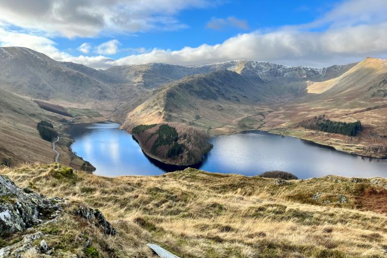
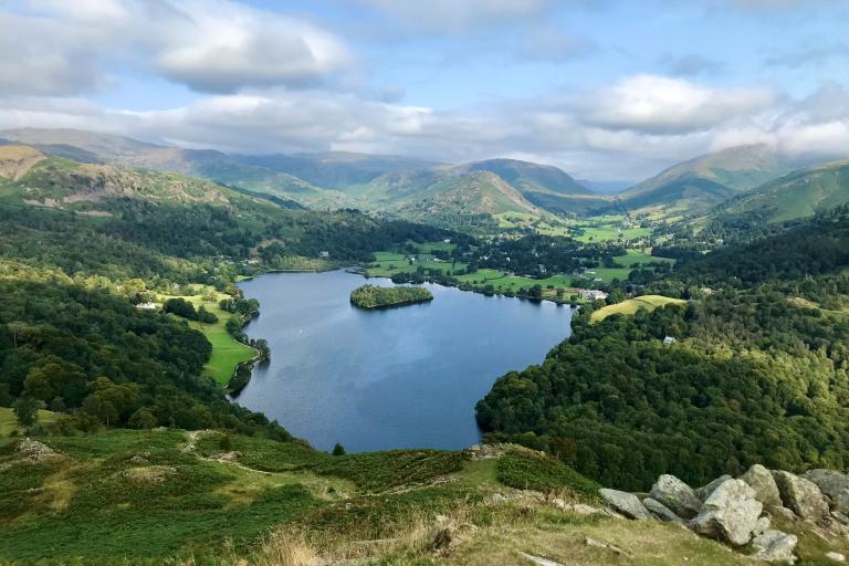
The county is home to a rich variety of nationally and internationally important habitats and species. Cumbria’s unique landscape is shaped by its geology, soils, and topography. Its natural environment has everything from the summit of England’s highest mountain, Scafell Pike, to the coastal and estuarine habitats of the Solway Coast and Morecambe Bay. It includes meadows, limestone pavement, ancient and broadleaved woodland, moorland and montane habitats, and rivers, lakes, and tarns.

The LNRS covers the county of Cumbria, as defined by the administrative boundaries of Cumberland Council and Westmorland and Furness Council. Cumbria includes the Lake District National Park and part of the Yorkshire Dales National Park. It also includes Solway Coast National Landscape parts of Arnside and Silverdale National Landscape and the North Pennines National Landscape. Cumbria is a special place that deserves care and protection.
Cumbria is also divided into 12 National Character Areas (NCAs). Each NCA has its own ‘sense of place’ defined by a unique landscape character made up of biodiversity, geodiversity, history, and cultural and economic characteristics. These have shaped (and still shape) the landscape over time through natural and man-made processes and land uses. Summaries of each area’s characteristics, features, habitats, species, geology, statistics, other data and statements of environmental opportunities are on the NCA website.
The county has multiple designated sites with special nature conservation status. These are subject to legal protection or are protected through local planning policies. The sites have been designated to reflect the international, national, and county importance of the habitats and species they support, such as freshwater pearl mussel, curlew, and natterjack toad. Cumbria also hosts a number of irreplaceable habitats including ancient woodland, ancient and veteran trees, blanket bog, limestone pavement, coastal sand dunes, and lowland fen. These designated sites and irreplaceable habitats are classed as Areas of Particular Importance for Biodiversity. Some sites or habitats can have overlapping designations. Information on why a statutory site has been designated can be found on the Natural England Site View webpage.
Cumbria’s natural and cultural landscape includes:
- 2 National Parks
- Lake District National Park
- Yorkshire Dales National Park
- 3 National Landscapes
- Solway Coast National Landscape
- Arnside and Silverdale National Landscape
- North Pennines National Landscape
- 12 National Character Areas (NCAs)
- Border Moors and Forests
- Tyne Gap and Hadrian’s Wall
- North Pennines
- Eden Valley
- Solway Basin
- West Cumbria Coastal Plain
- Cumbria High Fells
- South Cumbria Low Fells
- Morecambe Bay Limestones
- Howgill Fells
- Orton Fells
- Yorkshire Dales
- 2 UNESCO World Heritage Sites
- The Lake District
- Hadrian’s Wall
- 1 UNESCO Global Geopark
Cumbria is home to:
- 31 Special Areas of Conservation (SAC)
- 3 Special Protection Areas (SPA)
- 5 Ramsar Sites (wetlands of international importance)
- 288 Sites of Special Scientific Interest (SSSI)
- 26 National Nature Reserves (NNR)
- 10 Local Nature Reserves (LNR)
- 1617 County Wildlife Sites (CWS)
- 1 Marine Conservation Zone (MCZ)
- 1 Highly Protected Marine Area (HPMA)
In addition to land-based designations, Cumbria has one Marine Conservation Zone (MCZ) which overlaps with the LNRS area. The Cumbria Coast MCZ stretches approximately 27 km along the coast of Cumbria, from south of Whitehaven, around the cliffs at St Bees Head to the mouth of the Ravenglass estuary. MCZs protect typical, rare or declining habitats and species found in our seas. Cumbria also has one of England’s first Highly Protected Marine Areas (HPMA), designated at Allonby Bay in 2023. These are areas of the sea including the shoreline that allow the protection and full recovery of marine ecosystems.
Most of Cumbria’s rural landscape is managed by farmers and private landowners. However, significant areas are owned by public bodies (e.g. the Ministry of Defence, United Utilities and Forestry England), or conservation bodies (like the National Trust and Cumbria Wildlife Trust). Whilst Cumbria is predominantly rural, there are several urban areas. These include the city of Carlisle, and the towns of Barrow-in-Furness, Ulverston, Kendal, Keswick, Penrith, Appleby-in-Westmorland, Maryport, Workington and Whitehaven amongst others. Urban parks, gardens, and other public green spaces also provide important habitat that can support biodiversity.
Alongside Cumbria’s natural land and seascape, the area is also important for engineering and manufacturing, energy, food production, forestry, tourism, and culture and heritage. So it is unsurprising that alongside the 500,000 people who call Cumbria home, many visitors enjoy spending time in Cumbria’s natural landscape. Over 42 million people came to the county in 2023, primarily to visit a lake, the countryside, or to go walking. Five of the UK’s National Trails cross our county including the Pennine Way, Pennine Bridleway, Hadrian’s Wall Path, King Charles III England Coast Path and the Coast-to-Coast Path.
A survey conducted to gather views on nature in Cumbria received 786 responses. This exemplified how important Cumbria’s natural landscape is to local people and visitors. It is widely documented that nature brings wider benefits to people but when asked why spend time in nature, participants responded that they do so to enjoy natural beauty (81%), to exercise (59%) and to improve mental health (51%). Other responses mentioned farming, angling, volunteering, photography, and for socialising. All responses show the importance of creating and maintaining sustainable places and spaces for people and wildlife.
Acknowledgments
This LNRS was produced with contributions from the following:
- Westmorland and Furness Council, as the Responsible Authority
- the following Supporting Authorities:
- Cumberland Council
- Lake District National Park Authority
- Yorkshire Dales National Park Authority
- Natural England
- Cumbria Local Nature Partnership, who supported the strategy development throughout
- Cumbria Biodiversity Data Centre, who collated all spatial data and created the Local Habitat Map
- Natural England, Forestry Commission and Environment Agency, who provided technical input to inform this strategy
- Over 650 organisations and interested parties, who engaged with the LNRS either through newsletters and updates, attendance at workshops, or membership of technical working groups
We would like to thank all those who contributed to the LNRS and everyone who will bring the strategy to life.

